|
COMETS EARTH JUPITER KUIPER BELT MARS MERCURY METEORITES NEPTUNE OORT CLOUD PLUTO SATURN SOLAR SYSTEM SPACE SUN URANUS VENUS ORDER PRINTS
PHOTO CATEGORIES SCIENCEVIEWS AMERICAN INDIAN AMPHIBIANS BIRDS BUGS FINE ART FOSSILS THE ISLANDS HISTORICAL PHOTOS MAMMALS OTHER PARKS PLANTS RELIGIOUS REPTILES SCIENCEVIEWS PRINTS
|
Related Document
Download Options
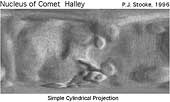
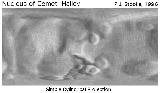
This is a shaded relief map of the nucleus of Comet 1/P Halley. It is the same map as Halley.gif, but has been reprojected to the Simple Cylindrical projection. As with all maps, it is the cartographer's interpretation and not all features are necessarily certain given the limited data available - this interpretation stretches the data as far as is feasible. Positions in the map are controlled by a digital shape model, to be described in a future paper. For this map the three dimensional convex hull of the shape model was projected into the Morphographic Conformal Projection (the conventional Stereographic Projection modified for non-spherical worlds). The relief drawing, initially prepared on that projection, was scanned and reprojected to this cylindrical projection. Longitude 180, defined arbitrarily, runs down the centre of the map. Halley is a particularly difficult object to map, given the nature of the data available. Many other interpretations might be possible. This relief drawing represents an attempt to show features visible on the disk in various spacecraft images, and the various ridges and hollows suggested by limb topography. Future work will involve attempting to locate active regions on the surface. My colleague Alain Abergel provided pointing data and other help throughout this mapping project, but any flaws in the map are entirely my responsibility. This version of the file, with labels intact, is in the public domain. Philip Stooke, Department of Geography, University of Western Ontario, London, Ontario, Canada N6A 5C2 stooke@sscl.uwo.ca |