|
COMETS EARTH JUPITER KUIPER BELT MARS MERCURY METEORITES NEPTUNE OORT CLOUD PLUTO SATURN SOLAR SYSTEM SPACE SUN URANUS VENUS ORDER PRINTS
PHOTO CATEGORIES SCIENCEVIEWS AMERICAN INDIAN AMPHIBIANS BIRDS BUGS FINE ART FOSSILS THE ISLANDS HISTORICAL PHOTOS MAMMALS OTHER PARKS PLANTS RELIGIOUS REPTILES SCIENCEVIEWS PRINTS
|
Related Documents
Download Options
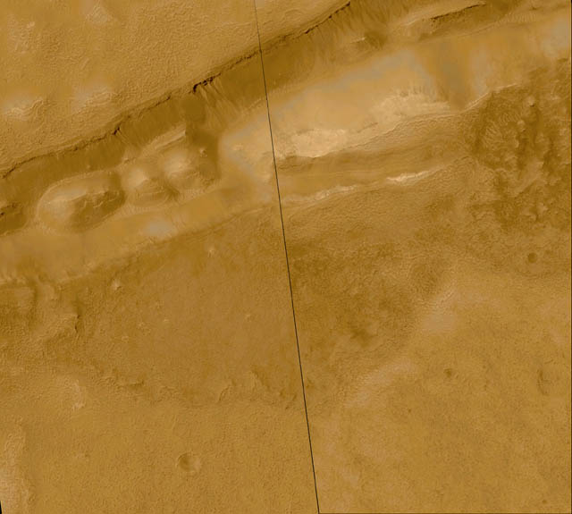
This mosaic of two Mars Global Surveyor (MGS) Mars Orbiter Camera (MOC) images shows about 20 different gullies coming down the south-facing wall of a trough in the Sirenum Fossae/Gorgonum Chaos region of the martian southern hemisphere. Each channel and its associated fan--or apron--of debris appears to have started just below the same hard, resistant layer of bedrock located approximately 100 meters (about 325 feet) below the top of the trough wall. The layer beneath this hard, resistant bedrock is interpreted to be permeable, which allows ground water to percolate through it and--at the location of this trough--seep out onto the martian surface. The channels and aprons only occur on the south-facing slope of this valley created by faults on each side of the trough. The depression is approximately 1.4 km (0.9 mi) across. The mosaic was constructed from two pictures taken on September 16, 1999, and May 1, 2000. The black line is a gap between the two images that was not covered by MOC. The scene covers an area approximately 5.5 kilometers (3.4 miles) wide by 4.9 km (3.0 mi) high. Sunlight illuminates the area from the upper left. The image is located near 38.5°S, 171.3°W. MOC high resolution images are taken black-and-white (grayscale); the color seen here has been synthesized from the colors of Mars observed by the MOC wide angle cameras and by the Viking Orbiters in the late 1970s. |
