|
COMETS EARTH JUPITER KUIPER BELT MARS MERCURY METEORITES NEPTUNE OORT CLOUD PLUTO SATURN SOLAR SYSTEM SPACE SUN URANUS VENUS ORDER PRINTS
PHOTO CATEGORIES SCIENCEVIEWS AMERICAN INDIAN AMPHIBIANS BIRDS BUGS FINE ART FOSSILS THE ISLANDS HISTORICAL PHOTOS MAMMALS OTHER PARKS PLANTS RELIGIOUS REPTILES SCIENCEVIEWS PRINTS
|
Related Document
Download Options
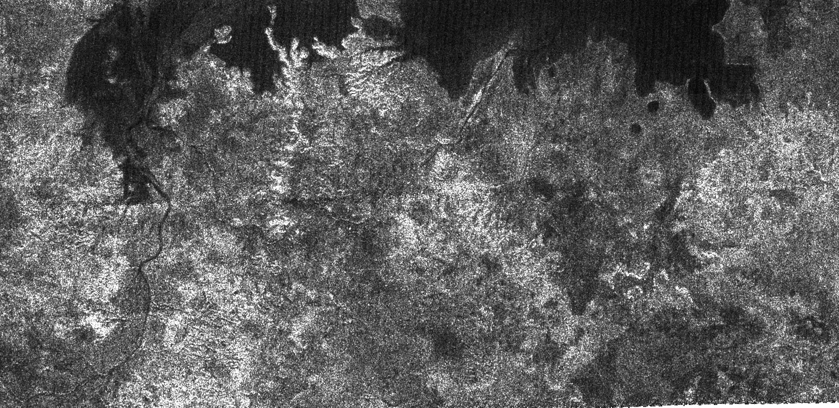
Using its radar system, the Cassini spacecraft has imaged new lakes on Titan. The large dark patch seen on this image, at high latitudes surrounding Titan's north pole, is most likely a hydrocarbon lake. Several dark channels can be seen; the longest one at the left meanders over almost 100 kilometers (62 miles), and appears to drain into the lake. Some dark channels are remarkably straight, suggesting possible faulting in the subsurface. The bright landforms jutting into the lake indicate that old, eroded landforms may have flooded. For a different radar view from the same flyby see PIA01943. This radar image was acquired by the Cassini radar instrument in synthetic aperture mode on Oct. 9, 2006. The image is centered near 73 degrees north latitude, 343 degrees west longitude, and measures about 300 kilometers by 140 kilometers (190 miles by 90 miles). Smallest details in this image are about 500 meters (1,640 feet) across. |
