|
COMETS EARTH JUPITER KUIPER BELT MARS MERCURY METEORITES NEPTUNE OORT CLOUD PLUTO SATURN SOLAR SYSTEM SPACE SUN URANUS VENUS ORDER PRINTS
PHOTO CATEGORIES SCIENCEVIEWS AMERICAN INDIAN AMPHIBIANS BIRDS BUGS FINE ART FOSSILS THE ISLANDS HISTORICAL PHOTOS MAMMALS OTHER PARKS PLANTS RELIGIOUS REPTILES SCIENCEVIEWS PRINTS
|
Related Document
Download Options
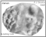
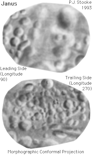
This image is a shaded relief map of Janus, the larger co-orbital satellite of Saturn. As with all maps, it is the cartographer's interpretation and not all features are necessarily certain given the limited data available - this interpretation stretches the data as far as is feasible. The original map was published in its full form with latitude-longitude grid, in: Stooke, P.J. and Lumsdon, M.P., 1993. "The Topography of Janus", EARTH, MOON AND PLANETS, V. 62, pp. 223-237. Positions in the map are controlled by a digital shape model, described in that paper. For this map, the three dimensional convex hull of the shape model was projected into the Morphographic Conformal Projection (the conventional Stereographic Projection modified for non-spherical worlds). The leading side (longitude 90 runs vertically down the centre) faces forwards in the orbit of Janus. The trailing side (longitude 270 runs vertically down its centre) faces backwards along the orbit. Longitude 0 is at the righthand end of the leading side, and faces Saturn. As with all conformal (true shape) projections, the scale in these maps varies, increasing from the centre to the outer edge. The map projection is described in: Stooke, P.J. and Keller, C.P., 1990. "Map Projections for Non-Spherical Worlds / the Variable-Radius Map Projections", CARTOGRAPHICA, V. 27, No. 2, pp. 82-100. This version of the file, with labels intact, is in the public domain. Philip Stooke, Department of Geography, University of Western Ontario, London, Ontario, Canada N6A 5C2 stooke@sscl.uwo.ca |