|
COMETS EARTH JUPITER KUIPER BELT MARS MERCURY METEORITES NEPTUNE OORT CLOUD PLUTO SATURN SOLAR SYSTEM SPACE SUN URANUS VENUS ORDER PRINTS
PHOTO CATEGORIES SCIENCEVIEWS AMERICAN INDIAN AMPHIBIANS BIRDS BUGS FINE ART FOSSILS THE ISLANDS HISTORICAL PHOTOS MAMMALS OTHER PARKS PLANTS RELIGIOUS REPTILES SCIENCEVIEWS PRINTS
|
Related Document
Download Options
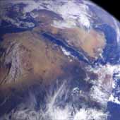
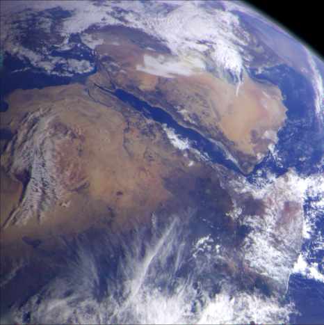
This image of northeast Africa and the Arabian Peninsula was taken from an altitude of about 500,000 kilometers (300,000 miles) by the Galileo spacecraft on December 9, 1992, as it left Earth en route to Jupiter. Visible are most of Egypt (left of center), including the Nile Valley; the Red Sea (slightly above center); Israel; Jordan, and the Arabian Peninsula. In the center, below the coastal cloud, is Khartoum, at the confluence of the Blue Nile and the White Nile. Somalia (lower right) is partly covered by clouds. |