|
COMETS EARTH JUPITER KUIPER BELT MARS MERCURY METEORITES NEPTUNE OORT CLOUD PLUTO SATURN SOLAR SYSTEM SPACE SUN URANUS VENUS ORDER PRINTS
PHOTO CATEGORIES SCIENCEVIEWS AMERICAN INDIAN AMPHIBIANS BIRDS BUGS FINE ART FOSSILS THE ISLANDS HISTORICAL PHOTOS MAMMALS OTHER PARKS PLANTS RELIGIOUS REPTILES SCIENCEVIEWS PRINTS
|
Related Documents
Download Options
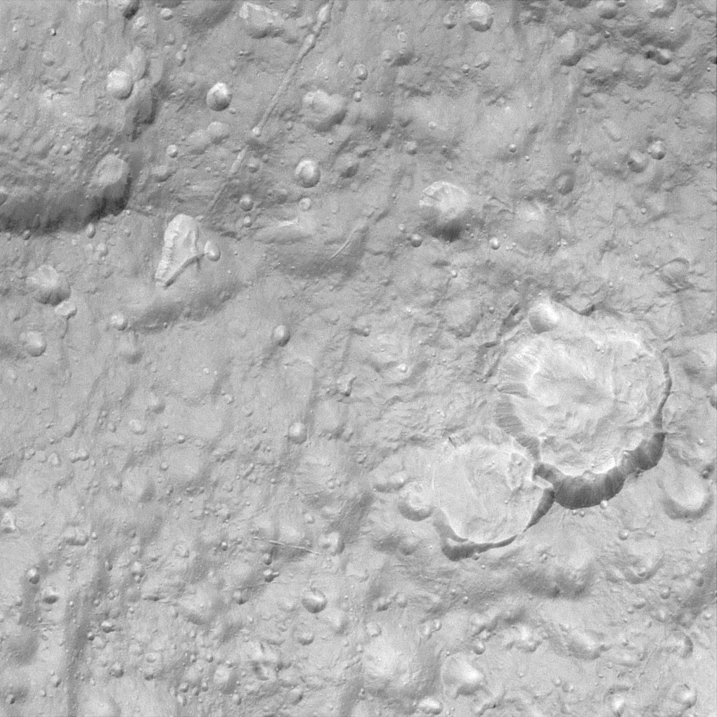
This view is among the closest Cassini images of Tethys' icy surface taken during the Sept. 24, 2005 flyby. This image is a clear-filter view and is the highest resolution image acquired by Cassini during the encounter. The two large craters at the right show evidence that landslides have modified their outlines and covered their floors with large quantities of debris. Linear depressions cutting across the terrain probably mark the surface expressions of faults or fractures. For a false-color image see PIA07737. This view is centered on terrain at approximately 4.2 degrees south latitude and 357 degrees west longitude on Tethys. The image has been rotated so that north on Tethys is up. The view was obtained using the Cassini spacecraft narrow-angle camera at a distance of approximately 19,000 kilometers (11,800 miles) from Tethys and at a Sun-Tethys-spacecraft, or phase, angle of 17 degrees. Image scale is 110 meters (360 feet) per pixel. |
